Introduction to remote sensing


Remote sensing refers to the science of acquiring information about an object without being in physical contact with it. The term is commonly used to refer to the acquisition of information on objects on Earth from a raised platform, such as an aeroplane or a satellite in space. As humans, three of the senses we use to interact with our surroundings do not require physical contact, which are the senses of sight, smell and hearing. However, it is the sense of sight that is comparable to remote-sensing due to the mechanism of the optics used by both systems. As a result, humans actively participate in remote sensing in their every-day lives.

There are two types of remote sensing systems:

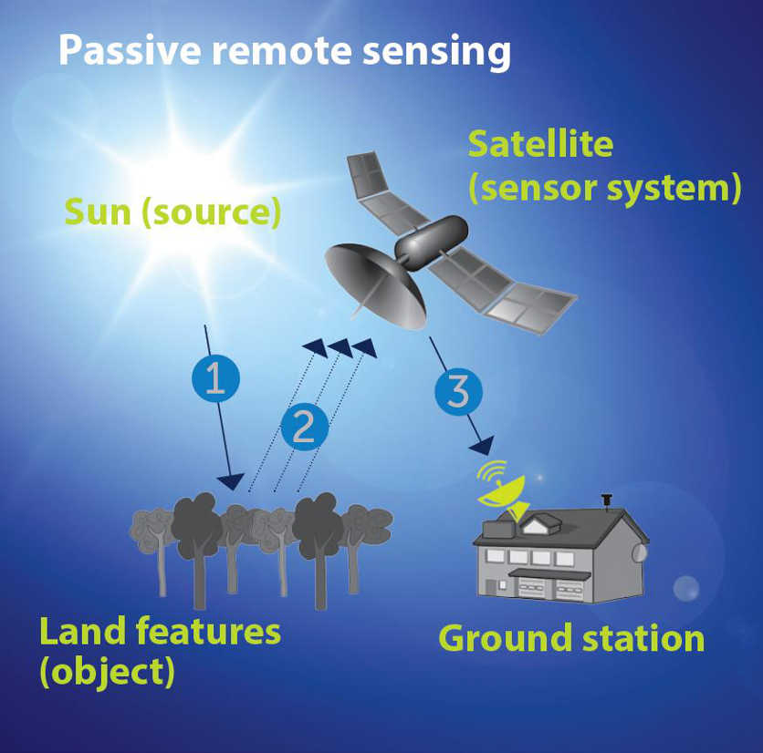
Passive sensors
rely on the sun to illuminate target objects, the sensor then records the reflected radiation emanating from the objects surfaces, primarily in the visible and near-infrared regions of the electromagnetic spectrum. Due to their dependence on the sun, these sensors are predominantly effective during the day. However, some passive sensors measure thermal radiation which can be also be measured during night time.
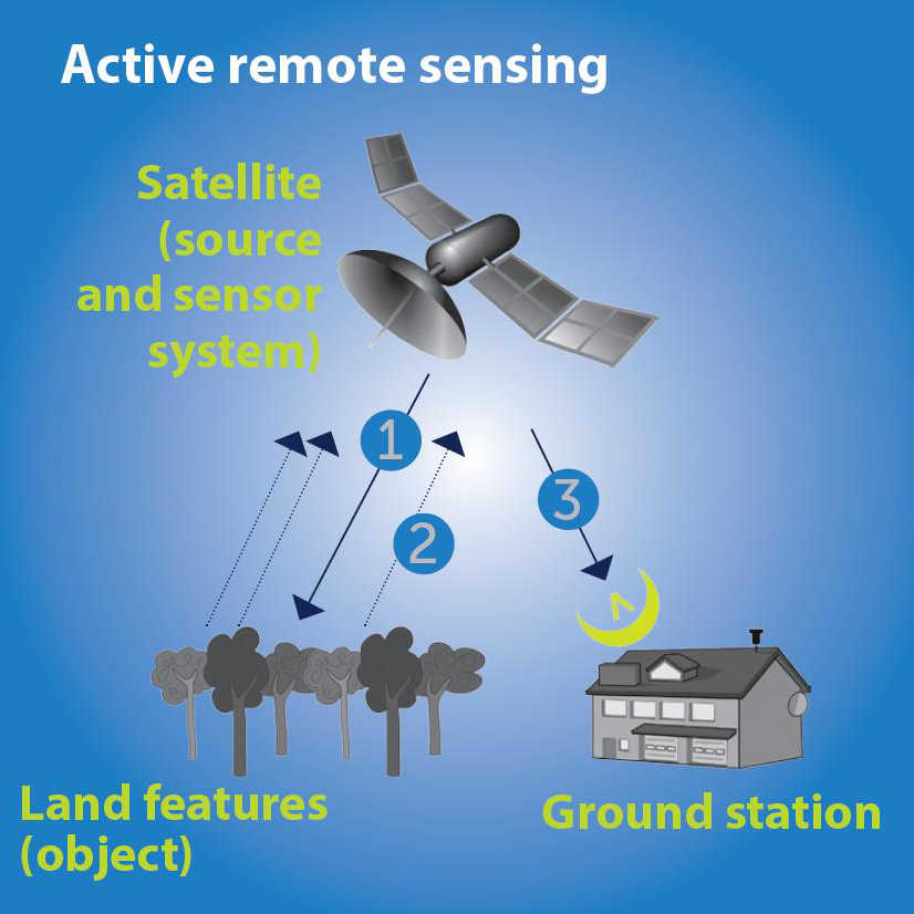
Active sensors
generate and transmit their own energy towards the target objects then record the returning signals. As a result, they are not dependent on the sun for illuminations. Such a mechanism allows active sensors to acquire information on the earth’s surface at any time of the day and in any weather condition as the transmitted signals can penetrate through haze, fog and cloud.

missing
missing

Legend:
1 = Energy source
2 = Energy returned (reflection/back scatter)
3 = Transmission of data to ground station


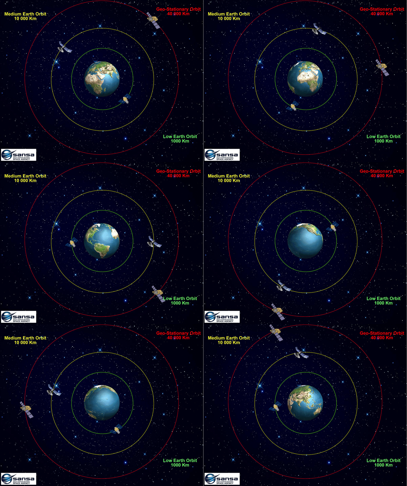
There are multiple remote-sensing applications cutting across different disciplines, such as monitoring and understanding vegetation and weather conditions, ocean dynamics, disaster risk and reduction. These applications use satellite images from different satellites that orbit the Earth at three different altitudes which are the Low Earth Orbit (2 000km), Medium Earth Orbit (20 000km) and the Geostationary orbit (36 000km). The altitude at which a satellite will orbit the earth is determined by different factors such as the principal objective of the satellite whether it will be used for navigation, telecommunication or earth observation. For most earth observation satellite the orbital altitude is determined by the size of the image pixel the size of each image pixel (spatial resolution), the period taken by the satellite to capture an image of the same point on earth (temporal resolution) and the extent of the ground to be covered by each image (swath).


Back to top


© Copyright: South African National Space Agency 2015. All rights are reserved.